
Archives
Maps and plans
The abbey as its monks drew it, then as its visitors photographed it: three centuries of documents.
The Maurists did not build without a plan. Every rebuilding scheme was drawn on the spot by a brother architect, sent to Saint-Germain-des-Prés, discussed and approved by the superiors. Seized at the Revolution, the plans of Mas-Garnier are held today by the French National Archives, in the series of maps and plans (N/III/Tarn-et-Garonne/1). The Conservatoire had them photographed; they are at the heart of the monograph on the abbey.
The plan of the whole enclosure, 1679
“Plan de tout l’enclos de l’abbaye de Mas-Granier-les-Verdun”, signed by Brother Christophle Lachezelle: the enclosure, ditches, paths, gardens, the river, and a summary plan of the abbey, at a scale of about 1:860. North is at the bottom; the compass, top right, marks the south.


The plans of the monastery, 1661
“Plans du monastère”, ground floor and first floor, signed by Brother Robert Plouvier in 1661 and approved by the superior Bernard Audebert in 1662. The wash distinguishes what exists from what is still to be built.


The church
The abbey church was demolished after 1790. Only its plans allow its nave to be recovered: a plan of the monastery church attributed to Brother Robert Plouvier (N/III/Tarn-et-Garonne/1/4) and a geometrical plan of 1688 (1/5).


The dormitory roof frame
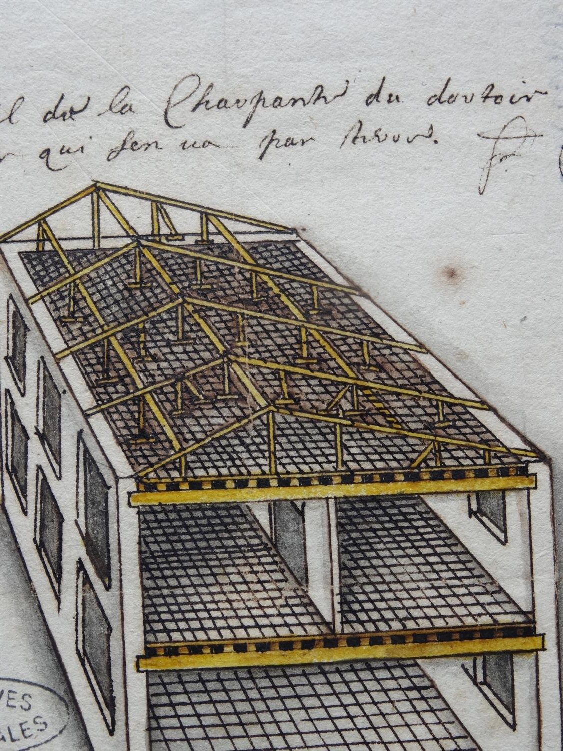
A perspective section in pen and wash, signed by Brother Christophle Lachezelle: the trusses, the purlins, the rafters, and even the cells of the dormitory. It is exactly dom Bédos’s manner: describe a craft by the plate.
Setting these drawings beside the roof frames still standing in the abbey is one of the exercises of the programme on describing the crafts.
The eighteenth-century schemes
Plans kept by the community of Benedictine nuns and passed to the Conservatoire: the great scheme for rebuilding the monastic quarters, which the Revolution interrupted.


The land register
On the Napoleonic land register of Mas-Grenier, section D, the place is named simply “l’Abbaye”. The plots still carry the trace of the enclosure: the ditch, the paths, the bank of the Garonne.
Departmental archives of Tarn-et-Garonne, 3 P 2407-18, section D. Research by Philippe Cachau, 2018.

The abbey in postcards
At the beginning of the twentieth century the postcard publishers photographed the house: the tower pavilion, the gallery, the little chapel in the grounds.
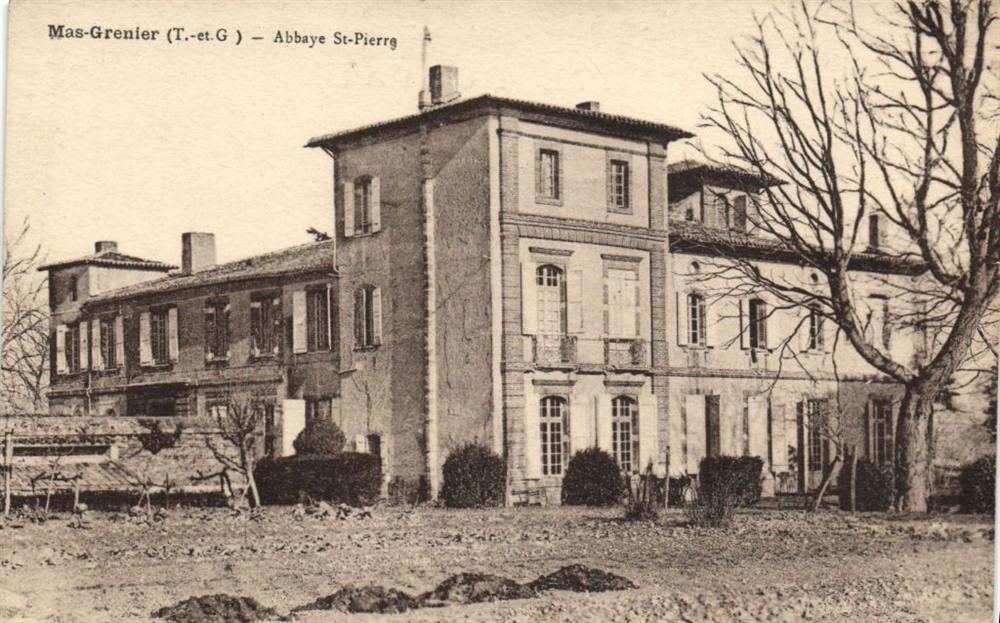


 About 1910Today
The tower pavilion, then and now.
From the air


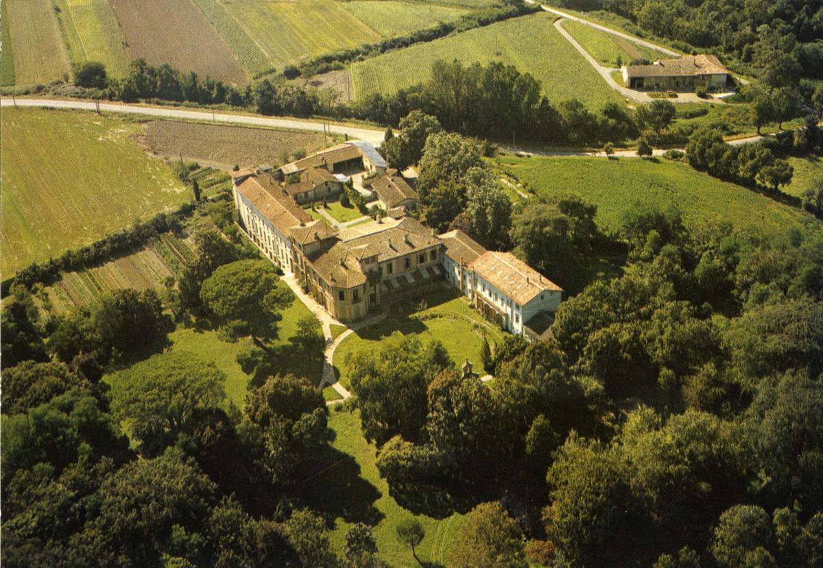
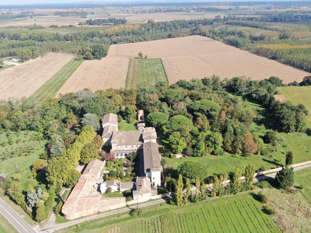

Where the abbey is
The seventeenth-century enclosure reached as far as the Garonne. On today’s map the river still runs east of the abbey.
The plans held by the French National Archives are reproduced from photographs taken by the Conservatoire for its research. Old postcards: private collections and the departmental archives of Tarn-et-Garonne. Map data © OpenStreetMap contributors.